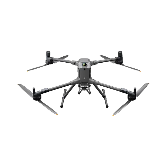
Takeoff Weight (with propellers)
Without Batteries: 5020±20 g
With Batteries: 9740±40 gThe actual product weight may vary due to differences in batch materials and external factors.
Max Takeoff Weight
15.8 kg
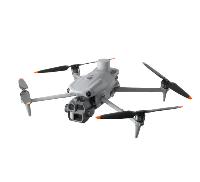
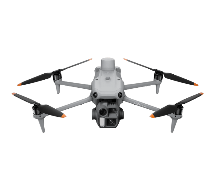
Dimensions
268×163×94.5 mm (L×W×H)
Width including external antenna folded, thickness including handle and controller sticks.
Max Payload
6 kg
The 6 kg payload is measured at the third gimbal connector under sea level conditions. Payload capacity decreases as altitude increases. For details, refer to the official user manual.
Diagonal Wheelbase
1070 mm
Max Horizontal Speed (at sea level, no wind)
25 m/s
Max Takeoff Altitude
7000 m
Max Flight Time (no wind)
59 minutes
Measured with the aircraft flying forward at a constant speed of 10 m/s in a windless environment at sea level, carrying only the H30T (total weight 10,670 g), and from 100% battery level until 0%. Data is for reference only. Actual experience may vary depending on the environment, usage, and firmware version.
Max Hover Time (no wind)
53 minutes
Measured with the aircraft hovering in a windless environment at sea level, carrying only the H30T (total weight 10,670 g), and from 100% battery level until 0%. Data is for reference only. Actual usage time may vary depending on the flight mode, accessories, and environment.
Max Flight Distance (no wind)
49 km
Measured by the aircraft flying forward at a constant speed of 17 m/s in a windless environment at sea level, without external payloads, and from 100% battery level until 0%. Actual experience may vary depending on the environment, usage, and firmware version.
Max Wind Speed Resistance
12 m/s
Max wind speed resistance during takeoff and landing.
Max Yaw Angular Velocity
Yaw: 100°/s
Operating Temperature
-20° to 50° C (-4° to 122° F)
Global Navigation Satellite System (GNSS)
GPS + Galileo + BeiDou + GLONASS*
* GLONASS is supported only when the RTK module is enabled.
Equipped with standard airborne ADS-B In receiver and dual antennas, supporting reception up to 20 km.
Hovering Accuracy Range (with moderate or no wind)
Vertical:
±0.1 m (with vision positioning)
±0.5 m (with satellite positioning)
±0.1 m (with RTK positioning)Horizontal:
±0.3 m (with vision positioning)
±0.5 m (with satellite positioning)
±0.1 m (with RTK positioning)
RTK GNSS Accuracy
RTK Fix:
1 cm + 1 ppm (horizontal), 1.5 cm + 1 ppm (vertical)
RTK Heading
Supports RTK heading with an accuracy better than 2°
Airborne ADS-B In
Equipped with standard airborne ADS-B In receiver and dual antennas, supporting reception up to 20 km.
Ports
USB-C Debug Port × 1: USB 2.0
E-Port V2 × 4: At the lower part of the drone, with 120W single-port power
Cellular Dongle 2 Interface × 2: On the underside of the drone
Beacon
Built into the aircraft
Ingress Protection Rating
IP55
The rating is not permanently effective and may decrease due to product wear and tear.
Maximum Payload for Single Gimbal Connector
1400 g
If exceeds, the gimbal damper lifespan will decrease from 1000 hours to 400 hours.
Maximum Payload for Dual Gimbal Connector
950 g
Maximum Payload for Third Gimbal Connector
3 kg for quick-release port, 6 kg for screw lock fastening
Sensing Type
Omnidirectional binocular vision system (surround view provided by full-color fisheye vision sensors)
Horizontal rotating LiDAR, upper LiDAR and downward 3D infrared range sensor
Six-direction mmWave radar
Forward
Measurement Range: 0.4-21 m
Detection Range: 0.4-200 m
Field of View (FOV): 90° (horizontal), 90° (vertical)
Backward
Measurement Range: 0.4-21 m
Detection Range: 0.4-200 m
Field of View (FOV): 90° (horizontal), 90° (vertical)
Lateral
Measurement Range: 0.6-21 m
Detection Range: 0.5-200 m
Field of View (FOV): 90° (horizontal), 90° (vertical)
Downward
Measurement Range: 0.5-19 m
The FOV to the front and rear is 160° and 105° to the right and left.
Operating Environment
Forward, Backward, Left, Right, and Upward:
Delicate texture on the surface, adequate light.Downward:
The ground has rich textures and sufficient lighting conditions*, with a diffuse reflection surface and a reflectivity greater than 20% (such as walls, trees, people, etc.).* Sufficient lighting conditions refer to an illuminance not lower than that of a nighttime city light scene.
Rotating LiDAR
Standard Measurement Range: 0.5-100 m @ 100,000 lux with 10% reflectivity target
Measurement Range for Power Line: 35 m @ 30° @ 10,000 lux for 21.6 mm steel-core aluminum stranded wire with a relative body tilt angle of 30° to the left and right
Field of View (FOV): 360° (horizontal), 58° (vertical)
Point-Frequency: 520,000 points/second
Laser Wavelength: 905 nm
Eye Safety Level: Class 1 (IEC60825-1:2014), eye-safe
Upper LiDAR (3D ToF)
0.5-25 m at night (reflectivity > 10%)
The FOV to the up and down is 60° and 60° to the right and left.
Downward 3D Infrared Range Sensor
Measurement Range: 0.3-8 m (reflectivity > 10%)
The FOV to the front and rear is 60° and 60° to the right and left.
mmWave Radar
Measurement Range for Power Line:
36 m for a 12.5mm steel-core aluminum stranded wire
50 m for a 21.6mm steel-core aluminum stranded wire
FOV: ± 45° (horizontal and vertical)The mmWave radar function is unavailable in some countries/regions.
Field of View (FOV)
DFOV: 150°
HFOV: 139.6°
VFOV: 95.3°
Night Vision
Starlight Grade
Video Transmission System
DJI O4 Enterprise Enhanced Video Transmission System
Live View Quality
Remote Controller: 3-channel 1080p/30fps
Operating Frequency and Transmitter Power (EIRP)
902-928 MHz: < 30 dBm (FCC), < 16 dBm (MIC)
1.430-1.444 GHz: < 35 dBm (SRRC)
2.4000-2.4835 GHz: < 33 dBm (FCC), < 20 dBm (CE/SRRC/MIC)
5.150-5.250 GHz: < 23 dBm (FCC/CE)
5.725-5.850 GHz: < 33 dBm (FCC), < 14 dBm (CE), < 30 dBm (SRRC)Operating frequency allowed varies among countries and regions. Refer to local laws and regulations for more information.
Max Transmission Distance (unobstructed, free of interference)
40 km (FCC)
20 km (CE/SRRC/MIC)Measured in an unobstructed environment free of interference. The above data shows the farthest communication range for one-way, non-return flights under each standard. During your flight, please pay attention to RTH reminder on the DJI Pilot 2 app.
Max Transmission Distance (with interference)
Strong interference (dense buildings, residential areas, etc.): approx. 1.5-6 km
Medium interference (suburban counties, city parks, etc.): approx. 6-15 km
Weak interference (open spaces, remote areas, etc.): approx. 15-40 kmData is tested under FCC standard in unobstructed environments of typical interference. Only to serve as a reference and provides no guarantee as to the actual flight distance.
Max Download Speed
Standard Mode: 80Mbps Downlink
Playback Download: < 25 MBps
Single-Channel Bitrate: ≤ 12 MbpsThe above data was measured under conditions where the aircraft and remote controller were in close proximity without interference.
Antenna
2T4R, 2.4GHz/5.8GHz multi-beam high-gain antenna
sub2G Module: 2T2R
Others
Supports Dual Control Mode and 2-channel Cellular Dongle 2
Max Charging Voltage
54.6 V
Weight
1.15 kg (without external battery)
Charging Temperature
5° to 40° C (41° to 104° F)
Discharging Temperature
-20° to 75° C (-4° to 122° F)
Battery Heating
Single Battery: Support
Onboard: Support
Battery Station: Support
Low-Temperature Charging
Supports low-temperature self-heating charging
Supported Batteries
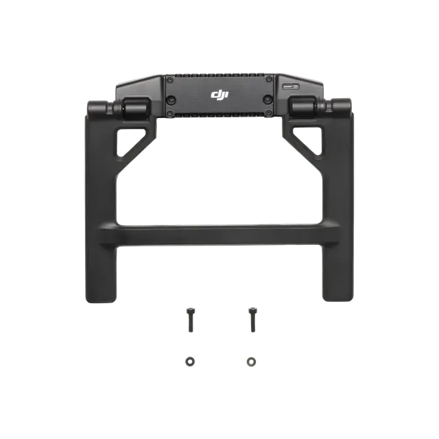
TB100 Intelligent Flight Battery, TB100C Tethered Battery
WB37 Battery
Input
100-240 V (AC), 50-60 Hz, 10 A
Output
USB-C:
TB100 Battery Interface:
100-110 V: Approx. 1185 W
110-180 V: Approx.1474 W
180-240 V: Approx. 2184 WWB37 Battery Interface:
100-240 V: Approx. 52 WUSB-C:
5.0 V 3.0 A, 9.0 V 3.0 A, 12.0 V 3.0 A, 15.0 V 3.0 A, 20.0 V 3.25 A
Number of Charging Channels
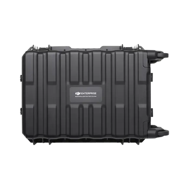
Three TB100 and two WB37 batteries
Charging Mode
Ready-to-Fly Mode 90%; Standard Mode 100%
Supports Fast Charging Mode and Silent Mode
Charging Time
2 hours for internal battery; 2 hours for internal plus external batteries.
When remote controller is powered off and using a standard DJI charger.
Video Transmission Operating Frequency and Transmitter Power (EIRP)
902-928 MHz: < 30 dBm (FCC), < 16 dBm (MIC)
2.400-2.4835 GHz: < 33 dBm (FCC), < 20 dBm (CE/SRRC/MIC)
5.150-5.250 GHz: < 23 dBm (FCC/CE)
5.725-5.850 GHz: < 33 dBm (FCC), < 14 dBm (CE), < 30 dBm (SRRC)Operating frequency allowed varies among countries and regions. Refer to local laws and regulations for more information.
Enhanced Transmission
Supports DJI Cellular Dongle 2
Wi-Fi Protocol
Wi-Fi Direct, Wireless Display, IEEE 802.11 a/b/n/ac/ax
Supports 2×2 MIMO Wi-Fi, dual-band simultaneous (DBS) support for dual MAC, with data rates up to 1774.5 Mbps (2×2 + 2×2 11ax dual-band simultaneous)
Wi-Fi Operating Frequency
2.4000-2.4835 GHz
5.150-5.250 GHz
5.725-5.850 GHz5.2 and 5.8GHz frequencies are prohibited in some countries. In some countries, the 5.2GHz frequency is only allowed for use in indoor.
Wi-Fi Transmitter Power (EIRP)
2.4 GHz: < 26 dBm, < 20 dBm (CE/SRRC/MIC)
5.1 GHz: < 23 dBm (FCC/CE/SRRC/MIC)
5.8 GHz: < 23 dBm (FCC/SRRC), < 14 dBm (CE)
Bluetooth Protocol
Bluetooth 5.2
Bluetooth Operating Frequency
2.400-2.4835 GHz
Bluetooth Transmitter Power (EIRP)
< 10 dBm
Screen Resolution
1920 × 1200
Touchscreen Control
10-Point Multi-Touch
Built-in Battery
2S2P High Energy Density 18650 Lithium-ion Battery (6500 mAh @ 7.2 V) 46.8 Wh
External Battery
Optional, WB37 (4920 mAh @ 7.6 V) 37 Wh
Charging Type
Supports PD fast charging, with a maximum 20V/3.25A USB Type-C charger
Storage Capacity
RAM 8G + ROM 128G UFS + expandable storage via microSD card
Internal Battery Runtime
3.8 hours
External Battery Runtime
3.2 hours
Indicators
Status LED, battery level LED, connection status LED, tricolor light, brightness adjustable according to ambient light
Storage Temperature
Within one month: -30° to 45° C (-22° to 140° F)
One to three months: -30° to 35° C (-22° to 113° F)
Three months to one year: -30° to 30° C (-22° to 86° F)
Supported Aircraft Model
Matrice 400
Global Navigation Satellite System
GPS + Galileo + BeiDou
System Version
Android 11
External Interfaces
HDMI 1.4, SD 3.0, USB-C with OTG support, max 65W PD charging, USB-A with USB 2.0 support
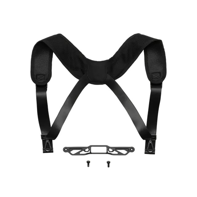
Accessories
Strap/waist support
DJI Products Compatible With Matrice 400
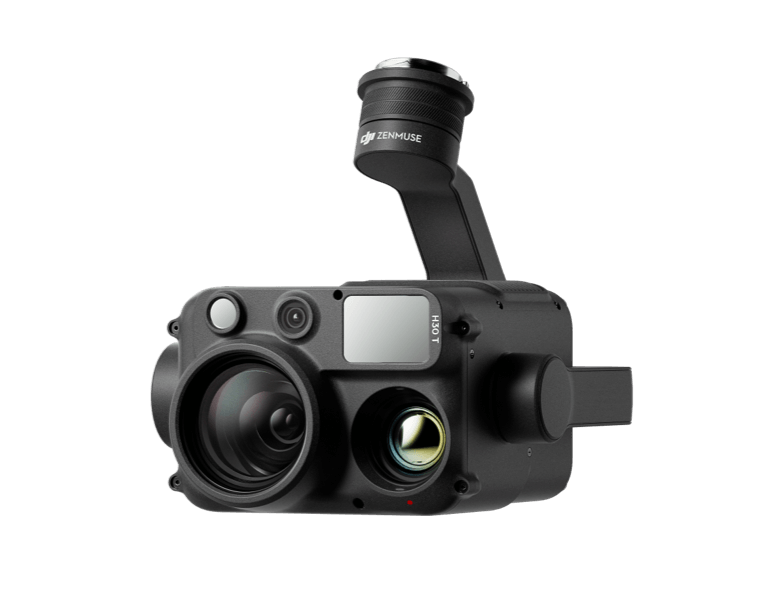
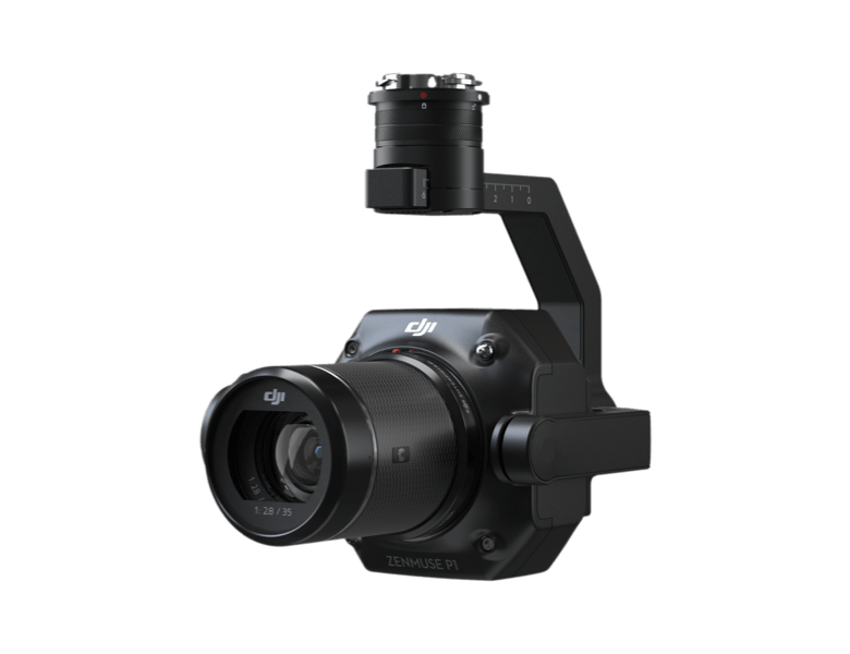
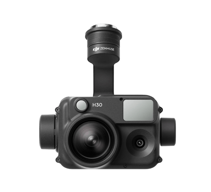
Gimbal Cameras: Zenmuse H30, Zenmuse H30T, Zenmuse L2 and Zenmuse P1
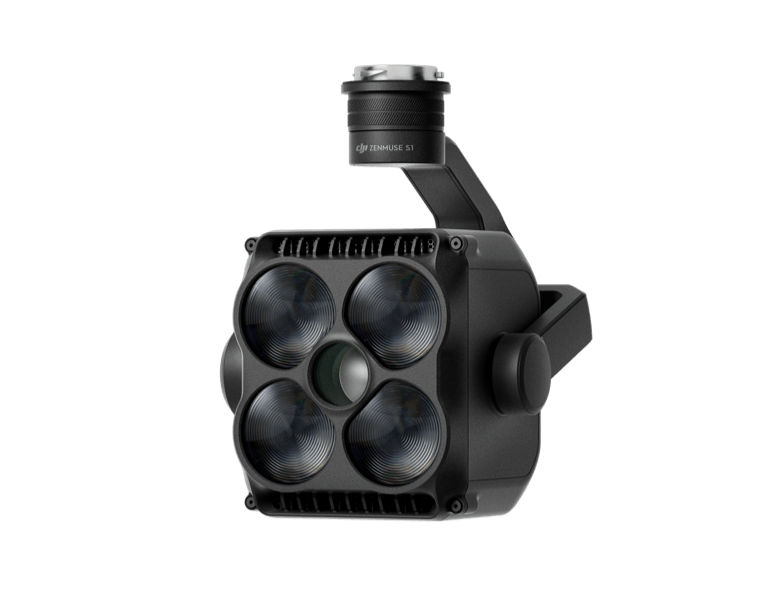
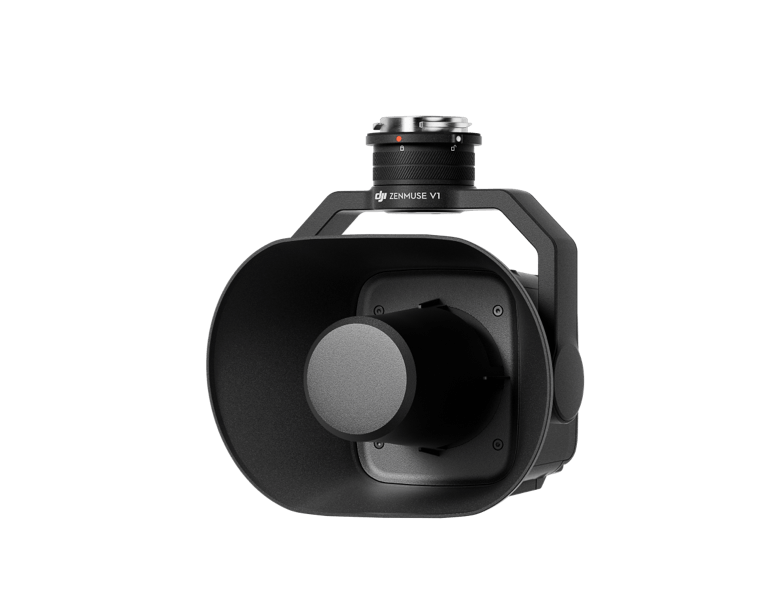
Accessories: Zenmuse S1 (drone spotlight), Zenmuse V1 (drone speaker), Manifold 3, DJI RC Plus 2 sub2G SDR Module, DJI Cellular Dongle 2
RTK Station: D-RTK 3 Multifunctional Station, D-RTK 2 Mobile Station
Ecosystem Accessories: DJI X-Port
DJI E-Port V2 Development Kit
DJI E-Port V2 Coaxial Cable Kit
DJI SKYPORT V3 Adapter Set
DJI SKYPORT V3 Coaxial Cable Kit